
Walking an Elyria Street by Address
An Elyria street directory works best as a repeatable parcel-by-parcel process. Start with the Lorain County Auditor Location Search, which is built for a structured address rather than a broad street-name guess. The result can connect the physical location to a permanent parcel number, owner or taxpayer fields, conveyance clues, and a legal description. Keep those items together. A modern street number alone may not survive a parcel split, a corrected address, or a change in how an older directory printed the number.
Move outward only after the first parcel is clear. The property card and map identify the legal property trail, while the voter report and historical directories add separate, dated views of registered voters or past households. None is a complete street roster. The sequence below keeps the question narrow and makes it easier to tell an ownership record from evidence that someone may have lived at an address at a particular time.
- Enter the full address in the Auditor location search and save the permanent parcel number, situs address, legal description, transfer date, and owner or taxpayer fields.
- Open the Lorain County GIS Parcel Viewer to confirm the parcel polygon and nearby street context.
- Use the Recorder's name, legal, date, or instrument routes to tie a recorded deed to that same legal description.
- Where a registered-voter question fits, use Lorain's address-sorted Walking List with the required precinct or district context.
- For an older household, compare the 1914 street census, later directory leads, census material, newspapers, or probate records with the property date.
Note: Keep a source date beside every name because an address match may describe ownership, registration, or a historic listing rather than present occupancy.
Elyria Street Directory Address Matching
The Auditor's structured route matters in Elyria. It separates street number, pre-direction, street, suffix, post-direction, unit designator, unit, city, state, ZIP code, and tax year. That lets an address with an east or west direction, an apartment, or a changed suffix be entered as the office keeps it. The owner-name search is useful for a legal owner or taxpayer name, but it is not a by-street occupant directory and can return more than one property.
Use a location match to establish property context first. The parcel result can show a situs, or physical property address, and a separate mailing field for tax correspondence. The mailing field can point to another property, a business, a trust, an estate, or an out-of-area address. It should never be presented as proof that the named owner lives at the parcel. That distinction protects the accuracy of every Elyria street directory search.
| Auditor location field | How it helps an address search |
|---|---|
| Street Number | Sets the house-number anchor before the street name is matched. |
| Pre-Direction / Street / Suffix / Post-Direction | Separates directional and street-format variations. |
| Unit Designator / Unit | Narrows a multi-unit location when the portal has a matching record. |
| City / State / ZipCode | Adds location context to a countywide search. |
| Tax Year and property type | Allows the supplied current or historic tax-year context and property controls. |
For a number that cannot be reconciled, retain nearby intersections, the parcel number, legal description, and estimated era. Elyria Engineering assigns addresses for new structures and can be asked about a specific assignment or readdressing record. No verified citywide renumbering table was located, so an individual record request is stronger than a blanket assumption.
Elyria Street Directory Parcel Terms
The same address can appear in several record systems, but the shared key is often the parcel and legal description. Copy the PIN exactly. Historic or retired parcel searches in GIS require a PIN without dashes. The legal description may name a lot, sublot, subdivision, survey, acreage, or other land reference. It is often the safest bridge when a street number has changed or lots were combined.
- Parcel or PIN
- A permanent property identifier used by the Auditor and GIS. It points to land, not a complete household.
- Situs address
- The physical tax location of the parcel. It differs from the address used for tax correspondence.
- Plat
- A recorded map or plan that can show lots, blocks, and subdivision relationships.
- Criss-cross directory
- A reverse address listing that can place a dated household at an address. Elyria's 1914 street census is the strongest verified local example.
The Auditor card may also show land use, community, tax district, school district, acreage, structures, values, exemptions, conveyance date, consideration, and deed volume or page. Those are property and tax facts. They do not identify every renter, visitor, or current household member on an Elyria street.
Mapping an Elyria Street Segment
The free GIS viewer has map and table views plus address, query, draw, print, measure, coordinates, selection, Layers, Basemaps, Buffer/Near-Me, and related controls. Use an exact address or selected parcel, then pan to the street segment. Its query tools can filter by owner name, exact address, land use, tax district, school district, community, acreage, market value, consideration, and date conveyed. The criteria combine with AND logic.
For a careful street study, select each parcel rather than running an empty query and calling the output a street directory. The viewer can supply the mapped polygon, adjacent parcels, district or community context, and historic or retired parcel references. Its map result identifies a property record. It does not establish that every name associated with a parcel is a neighbor or a resident.
Use the map print or a dated note to preserve the street layout while researching. Then open only the parcel cards needed for the question. This limits confusion between similar address strings and provides a clear route back to the Auditor record when a later deed, permit, or voter result refers to the same location.
Elyria Street Directory Record Sources
Different Elyria street directory sources answer different parts of an address question. The Auditor and GIS are the first property layer. The Recorder preserves recorded instruments. City departments can respond to an identified permit or address-assignment record. Lorain's voter reporting tool supplies a limited registration layer, and the 1914 directory gives a historic snapshot. Use the source that fits the date and claim being tested.
| Address record | Custodian | Useful result | Access boundary |
|---|---|---|---|
| Parcel and tax record | Lorain County Auditor | PIN, listed owner or taxpayer, situs and mailing fields, values, transfer clues | Free online name and location routes; ownership is not occupancy. |
| Parcel map | Auditor GIS / Tax Map | Parcel polygons, adjacent lots, districts, community, historic IDs | Free map; maps identify parcels rather than a household list. |
| Recorded instrument | Lorain County Recorder | Grantor, grantee, document, recording, and legal-description trail | Free PAX account required; local online cutoff is not published. |
| Voter report | Lorain County Board of Elections | Registered-voter entries sorted by address in a selected report | Protected records excluded; it is not a street census. |
| Building or Engineering record | City of Elyria | Dated project, application, work, or address-assignment context | Request by address, parcel, date, and record type; no verified open historic index. |
| Historic street census | 1914 directory / library sources | Dated listed people, intersections, and approximate owner notation | Historic snapshot, not current title or residence proof. |
The practical chain is address to PIN and legal description, then recorded document, then the appropriate dated household source. A property acquisition can show a legal connection without proving a move. A voter entry may add a registration date and precinct but does not name every adult at an address.
Elyria Street Directory Deed Trail
The Lorain County Recorder property-search guide explains that the live PAX index requires a free account. Once signed in, its Name Search accepts legal party names and can be narrowed by party role and recorded date. Advanced or Legal searching supplies document-category, consideration, and legal filters. Instrument Search accepts an instrument ID or book and page, with an option to include cross references. The PAX guide also describes summary, detail, and name result presentations.
Start with the owner or acquisition clues from the parcel card, then compare the recorded parties and legal description on the instrument. In a backward chain, the seller on one deed may be found as the prior grantee on an earlier purchase. Record the instrument identifier, book or page, recording date, and property language at each step. A common surname alone is not enough to join two transactions. Ohio's recorder indexing law, ORC §317.18, requires grantor, grantee, and legal-description indexing.
The official PAX portal displays its account gate before a search. It offers an important access route, but no precise local online index or image start year is published. Older material can require a Recorder counter inquiry. Certified copies require the Recorder's office, while the account workflow concerns searching and available document copies.
See the Recorder PAX access screen before beginning a street-directory deed search.
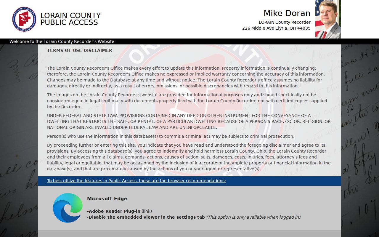
The account requirement is part of the research path, not a reason to infer that a missing online result means no Elyria recorded instrument exists.
Elyria Street Permits as Date Evidence
Building and Land and Engineering records can add a date-specific layer to an Elyria street directory search. The published new-residential application includes permit number, address, sublot, owner and contractor contact data, owner-occupied indicator, zoning and site-plan facts, work details, signatures, and inspection fields. An excavation or sewer form can document location, applicant or company, work category, and associated permit information. These materials may establish that an identified project was associated with a property. They do not identify all people who lived there.
The City has not published a verified historical open address-and-name index for permit, inspection, or code cases. Ask for a defined record using the street address or parcel number, approximate date, and permit or project type. The City forms and permits page supplies the municipal starting point. Residents using the eSuite permit portal need a parcel number, and the visible route is account based.
The City permit and records forms illustrate the address, parcel, and project trail available for a defined request.
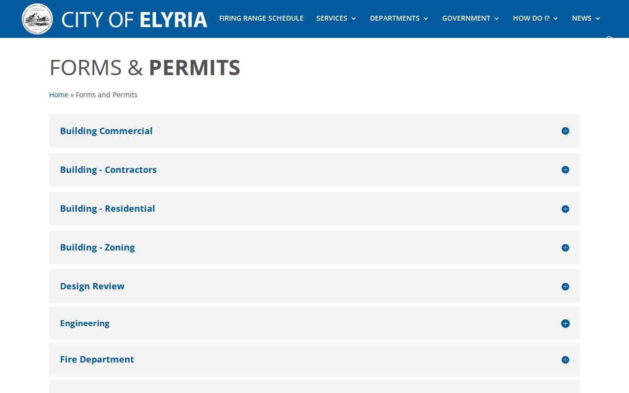
Use a permit image or form as dated property context, then cross-check it with the parcel and recorded-document trail.
Elyria Street Voter Walking Lists
Lorain County's voter reporting interface is the public street-level route, but it has narrow meaning. It offers Walking List sorting by voter address and precinct or district filters, with report, label, CSV, and statistical outputs. The tool also presents household grouping, mailing-address, voter-district, and election-history settings. Those controls are report options. They are not proof of family relationship, full household membership, or present physical residence.
Ohio registration records are public subject to exclusions in ORC §3503.13. Confidential registrations, protected voter addresses, contact details, identity numbers, and other protected data are not public. Safe at Home participants do not appear with residential address or precinct in the public voter database or public lists. A no-match means the supplied record was not returned; it does not prove a person has left Elyria or is unregistered.
For an address sequence, pick the proper precinct or district context, use the voter-address sort, and label any result as registered-voter information. The countywide Board of Elections is the fallback for a narrow records question. The historic household layer is separate and belongs in the relevant directory volume, not in a modern voter report.
Note: A Walking List is a registered-voter view with protected-record exclusions, not an Elyria street census or a complete household directory.
Elyria Street Directory in 1914
The digitized 1914 Directory of the City of Elyria, published by W. M. Lawrence & Co., contains both an alphabetical directory and a complete census of Elyria by streets. Streets are alphabetical, intersections are noted, and the volume supplies a rare reverse-address route for one historic moment. Household lines can include people at an address, owner or agent notation, and telephone information. It is valuable when a deed chain needs an independent, date-stamped household lead.
The volume itself supplies a caution that should remain with every historic address claim. Where two street numbers appear, the parenthetical number may be a displayed but incorrect number. The directions also explain that odd and even sides generally run on opposite sides as a street proceeds from its beginning. Log intersections and number variants before deciding an old address is wrong.
Approximate owner information in a directory came from occupants or neighbors and is not title proof. Confirm an owner claim through the Auditor and Recorder. For the collections themselves and later discrete years, use the Elyria City Directory resource rather than treating one historic volume as a continuous street-by-street series.
Elyria Street Directory Privacy Limits
No Elyria street directory can show every person who lives along a road. Parcel cards list property and tax information, not renters or all household members. A mailing address may differ from the property situs. Voter data covers registered electors only and excludes protected records. Utility and delivery accounts are not public street lists, and motor-vehicle personal information is protected by the federal Driver's Privacy Protection Act.
Ohio Safe at Home protects qualifying participants' confidential locations and public voter information. Public-service workers can seek online residential-address redaction under ORC §149.45. Sealed court records and confidential registration material also remain outside ordinary public access. If a record is unavailable, do not try to reconstruct protected details from other sources.